

Hello everyone,
It’s already the last week of the Beijing 2022 Winter Olympics, have you watched any games? There are a lot of “cold and chilly elements” on campus this week: we got more snow at the beginning of this week and Loeb Art Center is having a video installation about the Arctic screening in the next two Thursday evenings! Hence, I feel it would be interesting to have an Arctic map for this week’s map display.
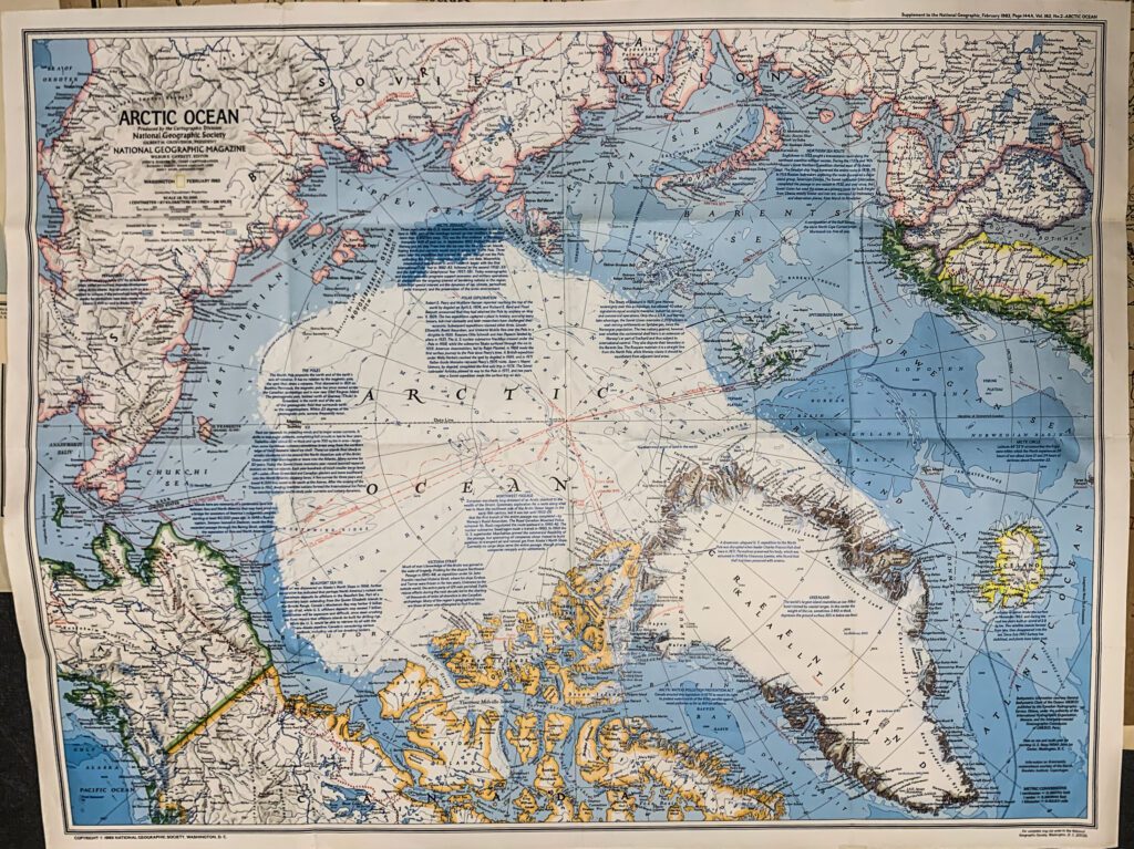
This well-painted and informative map is a supplement to the National Geographic magazine issued in February 1983. On the reverse side, there is a “People of the Arctic” historical guide which introduced indigenous tribes and their cultures. (I’m gonna upload the back side on Vassar Geospatial Mapping Hub so go visit the site if you are interested!)
The map is of planar projection. This type of projection, also called azimuthal projection, is very commonly used in mapping polar regions. The orientation of cold currents, warm currents, and prevailing winds are mapped out. The different blue colors in the coloring of the ocean reveal the ocean bathymetry. The long red lines across the north pole were the routes of Arctic expeditions that had been carried out in the last century by explorers around the world.
This map is also interesting for its abundance of historical and geographical notes. The contents of notes range from stories of past Arctic exploration, historical geopolitical events to facts about natural resources and icebergs in the Arctic. Scheduled air services along with other geological features are also labeled out. Overall, this is a really informative map for the magazine readers interested in the Arctic.
Have a great week!
Yidan Xu ‘24