
Vassar Academic Computing Services (ACS) staff have flown multiple drone imagery capture flights over the Beaver Pond area of the Preserve at Vassar for several years in support of ongoing research and teaching about the influence of these animals on the local ecology. The photos, taken at various times from 2016 to 2023, are available in an interactive web map. View the map here.
Click the “Imagery Viewer” button on the left to see which years/months are being compared and to change them to different ones:

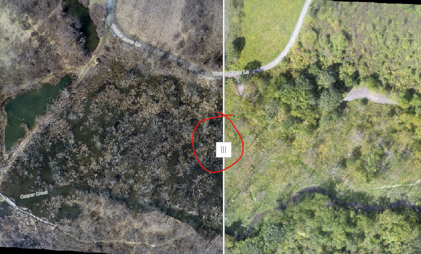
Use the slider in the middle to move over the left and right image:
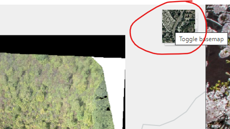
Click the button in the upper-right to toggle the basemap between a general topographic map and aerial imagery background (captured 2021).
If you have any questions or comments about the imagery or the tool, contact Academic Computing Consultant for GIS, Neil Curri.