
Hello everyone,
I hope everything is going well with your mid-term exams, papers, or projects! Spring Break is approaching and so are the exciting field trips! This map of California is for those who will go on the East California field trip. 🙂
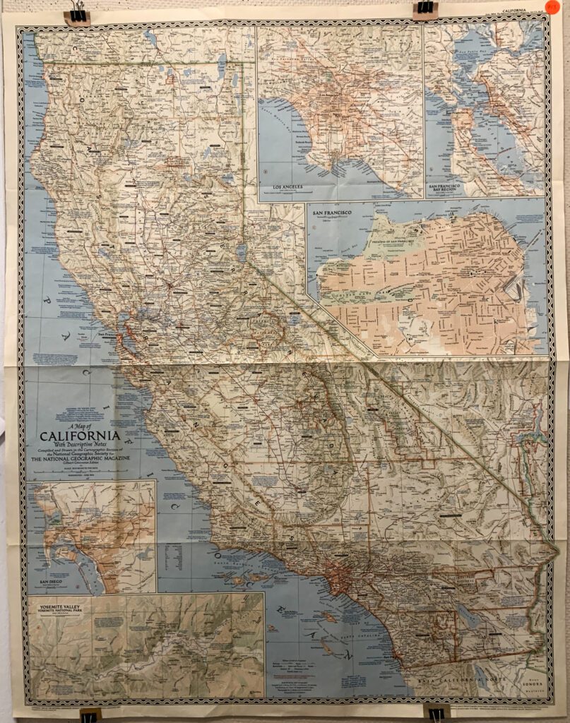
The map, which seems to belong to a map series, is a supplement to the National Geographic magazine issued in June 1954. The topographic base map is mapped out based on oblique cylindrical projection, with features such as railways, roads, cities, airports, and natural sites labeled out on top. Moreover, as an informative map for magazine readers, this map also included features like Gold-rush Towns as well as descriptive notes of interesting landmarks. The map is also rather useful and provides practical information for travelers: the mountain passes labeled in red will close in the first heavy snowfall and will not open till at least June.
Besides showing the map of the state, this map also has detailed sectional maps of major cities including San Diego, Los Angeles, and San Francisco and its bay region. In the city maps, streets and some public facilities are labeled out at block level. In addition, the Yosemite National Park also has its own sectional map at the bottom.
I put a sticker note on the approximate field trip spot on the map so go and check out the landforms ahead!
Happy Spring Break!
Yidan Xu ‘24