By: Iris Li (’26)
Hello everyone!
My name is Iris and I am the Map Curator for the Earth Science & Geography Department for this year, and guess what–Map of the Week (online) is BACK!!
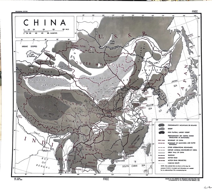
This week, I’d like to feature this physical-political-transportation map of China and surrounding areas, showing general biomes and various boundaries and transportation routes. This was published in WWII, so it makes perfect sense why they combined three map types together into one to gain a general sense of the land. The neighboring countries include India, Korea, Japan, Mongolia, Taiwan, and parts of Burma, Thailand, and the USSR.
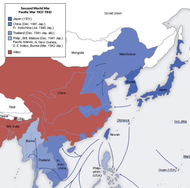
The depiction of biomes immediately caught my eye when I picked out this map. Most of this region is mountainous or uplands which makes it difficult to navigate topographically. To review why this is important, given WWII, the US was a member of the Allies (with UK, USSR, and China) against the Axis powers (mainly Japan, Italy, Germany). The map below shows WWII division up until 1942 so it’s an interesting comparison to see how the Japanese/Axis navigated their way through this terrain with the geographic isolation of China. Deserts and plateaus are located in the north and west, mountains along the southern and western borders, and roads and railways primarily in the east.
Something else that caught my eye was the “Caravan Route.” On the map, it’s on the border of the Gobi Desert and dry steppes in the north, and connects with the Red Basin, Burma, and Lower Yangtze River Basin. Since Japan dominated the seas in the east, traditional caravan routes served as vital supply lines despite being a slower route. The route incorporates part of the Silk Road, the Ancient Tea and Horse Caravan Route, and Stilwell Road (originally Burma Road). The Ancient Tea and Horse Caravan Route spanned 3,100 miles from Sichuan and Yunnan provinces in SW China through the Himalayas to India. The Burma Road (1938-1942) was cut by Japan, so the US and China built the Stilwell Road to connect Ledo, India, to China.
I hope you enjoyed reading, see you next week!