By Iris Li ’26
Hello everyone!
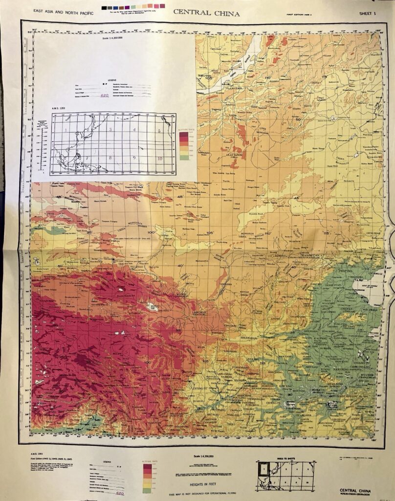
Welcome back from break – I hope it was restful/fun/exciting for all of you! For my final stretch as map curator for this wonderful department, we will be looking at fun Asia maps so I (and we) can hopefully explore Asia one day! We’ll start it off with this generalized topographic map of Central China by the Army Map Service, published in 1945. It takes a snippet of China/Mongolia/USSR/Bhutan/Burma, and is divided by color based on altitude/elevation.
This map was made in the heat of WW2 — China was a crucial ally to the US against Japan and the US funded loads of money to support China’s—the Nationalists (not Communists)—fight against Japan. However, the Chinese were split into Nationalists and Communists, leading to increased tensions outside of the US’ control. Geographically, you can see the Himalayas and neighboring Tibetan Plateau in the SW corner, desert area in the northern/central part of the map, and coastal areas towards the East China Sea/Yellow Sea/Gulf of China in the east. Honestly, China makes up about 60% of the map – Mongolia/USSR takes over the top part of it.
On the bottom of the map, it says, THIS MAP IS NOT DESIGNED FOR OPERATIONAL FLYING. It’s clear that the purpose was for ground-level operations rather than WW2 aviation because it’s not nearly detailed enough to navigate. Due to the extreme changes in elevation in China, the weather is pretty volatile especially near the Sichuan basin and relying on a generalized map could have been a death sentence for pilots flying based on this map. It’s interesting how pre-digital technology cartographers were able to document a massive area to provide a big picture rather than a detailed chart.
Hope you enjoyed!