
Ernest Dudley Chase, 1942
Hello everyone,
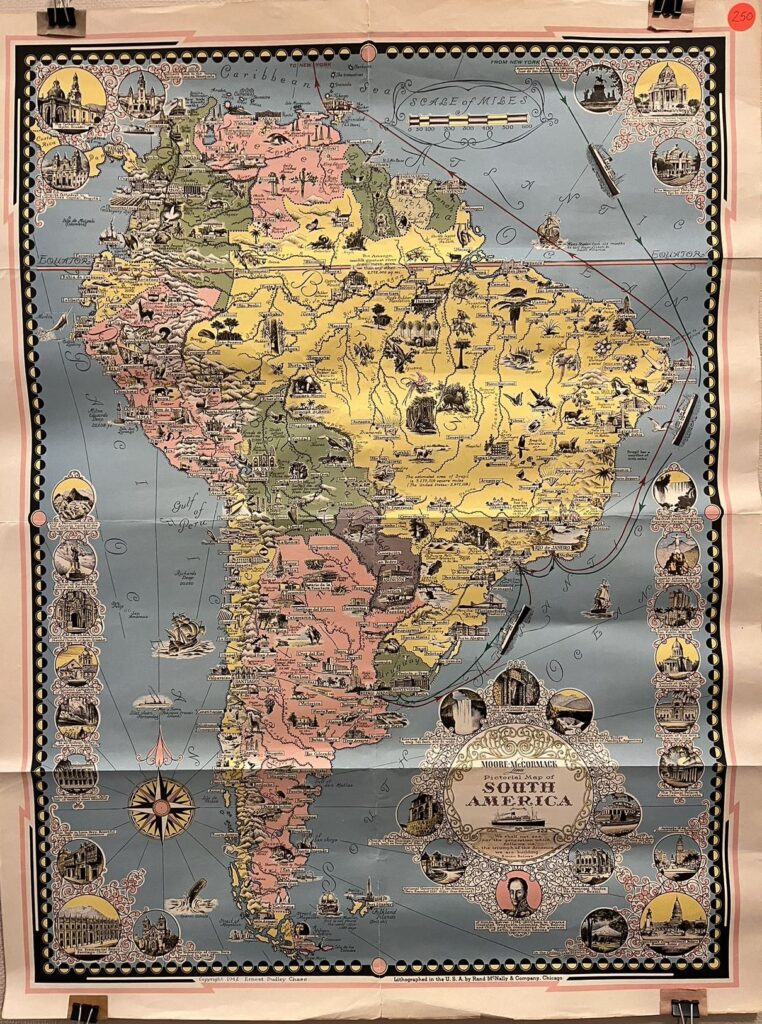
Welcome back to Vassar and Ely Hall! I hope you all had a restful and enjoyable spring break ;). Spring break is a great time to travel around and explore different cultures or natural wonders. This finely decorated “Moore-McCormack Lines Pictorial Map of South America” shows cultural landmarks, historical architecture, and natural sites in South America. Take a look if you want to travel there in the future!
The map was commissioned by Moore-McCormack Lines of New York, a Shipping Lines Company that mainly operates shipping routes between North and South America. During World War II, its vessels served as Navy ships and performed various military services such as troop transportation. Made in 1942, this pictorial map of South America not only shows the shipping routes between New York and South America but also highlights the solidarity between South America and the U.S. during the war times.
The map presents rivers, cities and towns, and major mountain ranges in South America, using colors to differentiate the territories of the neighboring countries. Small illustrations and annotations on the continent highlight flora and fauna, landmarks, and natural resources, with circular illustrations on the two sides featuring important architecture.
The title, located at the lower right of the map, is ornated by intricate patterns of vines. Beneath the title, there is a quote from and a portrait of Simon Bolivar, the Venezuelan liberator who led South American countries to gain independence from the Spanish Empire.
Have a great second-half of the spring semester!
Yidan Xu ’24