
The National Geographic Society, 1952
Gilbert Grosvener, editor
1: 27,500,000
Hello everyone,
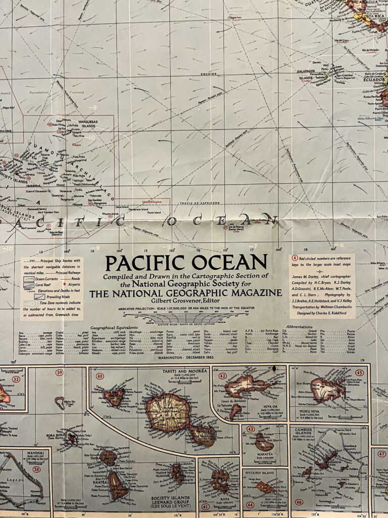
For this week’s map exhibition, I would like to feature this map of the Pacific Ocean from the National Geographic magazine. The formation of the Pacific Ocean started around 190 million years ago after the break of Pangea. The Pacific Ocean has the oldest marine crust and has perhaps the most volcanoes. Though this map was made in the middle of the 20th century, it shows not only the overall geography of the area but also presents great details of the islands.
The major section of this map shows the map of the Pacific Ocean on a scale of 1: 27,500,000. The numbered red boxes on the main map correspond to the inset maps of the islands. This map is also heavily annotated: major cities, especially coastal cities are labeled on the map. Principal ship routes are also marked out; some of the most prominent harbors include Honolulu, San Francisco, and Tokyo. Prevailing winds are expressed by the blue arrows whereas the surface ocean currents are shown by the gray arrows. The visualization of time zones is very detailed and straightforward. Moreover, beneath the legend in the “geographical equivalent” section, National Geographic also presents English translations of the geographical features in indigenous languages
One thing that I found very interesting is that the areas of coral reefs are also marked out on the map. Quite a few maps of atolls are shown on the top left of the layout. Atoll islands are arguably some of the most vulnerable places to climate change because they consist of small areas of land that are only 1–5 m above mean sea levels. Global warming and sea level rise could threaten the atoll islands and the associated ecosystems severely.
Have a great week!
Yidan Xu ’24