
Hi everyone, welcome back to campus!
I hope you all have a great winter break. As we are all now back on campus, I thought it would be exciting to look into an old campus map.
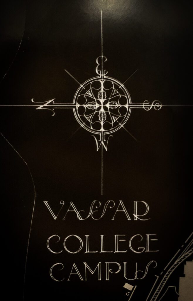
Though the date of production is unknown, this 1: 1200 scale Vassar College Campus map was created by a person with the initial O.T.W. using negative photography techniques. The map is printed on a sheet of transparent plastic film. Since the negative sheet is made for blueprint making, the image on the sheet is reversed on the colored side. By exposing the plastic film sheet under light and processing it through chemical solutions, the transparent areas would appear colored and the black areas would remain uncolored on the blueprint paper.
The negative sheet itself is aesthetically pleasing with minimalistic decorations. Lakes are contoured by gradient lines. Letters are smoothly written in beautiful fonts and the north arrow is finely decorated like a rose window.
The map portrayed a relatively different campus than what we have today. Some of the familiar sites–such as the new observatory, bridge, south commons–have not been built. The Noyes circle is also slightly different. Intriguingly, some part of the Ferry House is contoured by dot lines. Moreover, in the area next to the Golf court where we now have the Athletics and Fitness Center (built in 2000), there was no building but only open Ballintine fields. So we can at least be sure that this map was made in the last century.
Do you have any thoughts on the date of production? Take a guess!
Have a great new semester 🙂
Yidan Xu ‘24