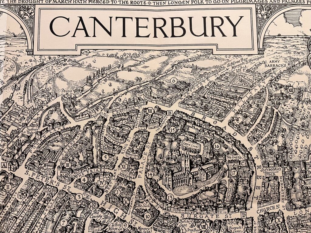

A Pictorial Map of Canterbury
1931, by G. Spencer Hoffman
George Philip & Son, LTD.
Hello everyone,
Up into the finals, I hope everything is going well with projects and exams! This week, I would like to feature this beautiful pictorial map of Canterbury made by cartographer and architect George Spencer Hoffman (1875-1950). Spencer Hoffman is an accomplished cartographer in early 20th century England and has made many pictorial maps of Great Britain cities. This Canterbury map is the third and last one in the Philips’ Wayabout Map series, which also includes the map of Oxford and the map of Cambridge.
Seemingly made for tourists, this delicate pictorial map depicts principal landmarks and historic buildings of the city. The Canterbury city wall, first built by the Romans between 270 and 280 AD, is illustrated on one side and represented by dashed lines on the other side. On the lower left corner, Spencer Hoffman listed out the places of interest while on the lower right corner, he has paced the legend for churches and city buildings. Specifically, places of interest are referenced by Arabic numbers, cathedrals and churches are identified by Roman numerals, and City Buildings are labeled by letters of the alphabet.
This map also presents illustrations that identify with its medieval history and prestigious culture. The coat of arms of the city lies on the upper left corner of the map. The icon on the lower left, captioned “The Black Prince,” depicts Edward of Woodstock, the eldest son of King Edward III of England. On the other side, Spencer Hoffman depicts Saint Tomas Becket, archbishop of England. Both the Black Prince and St. Tomas Becket were buried in Canterbury Cathedral. Specifically, St. Tomas Becket was martyred at the cathedral and it is his death that made the church a place of pilgrimage. On the bottom of the map, Spencer Hoffman illustrated Geoffrey Chaucer, the English poet who wrote The Canterbury Tales in the late 14th century.
Happy Founder’s Day and good luck with finals!
Yidan Xu ’24