by Iris Li ’26
Hello everyone!
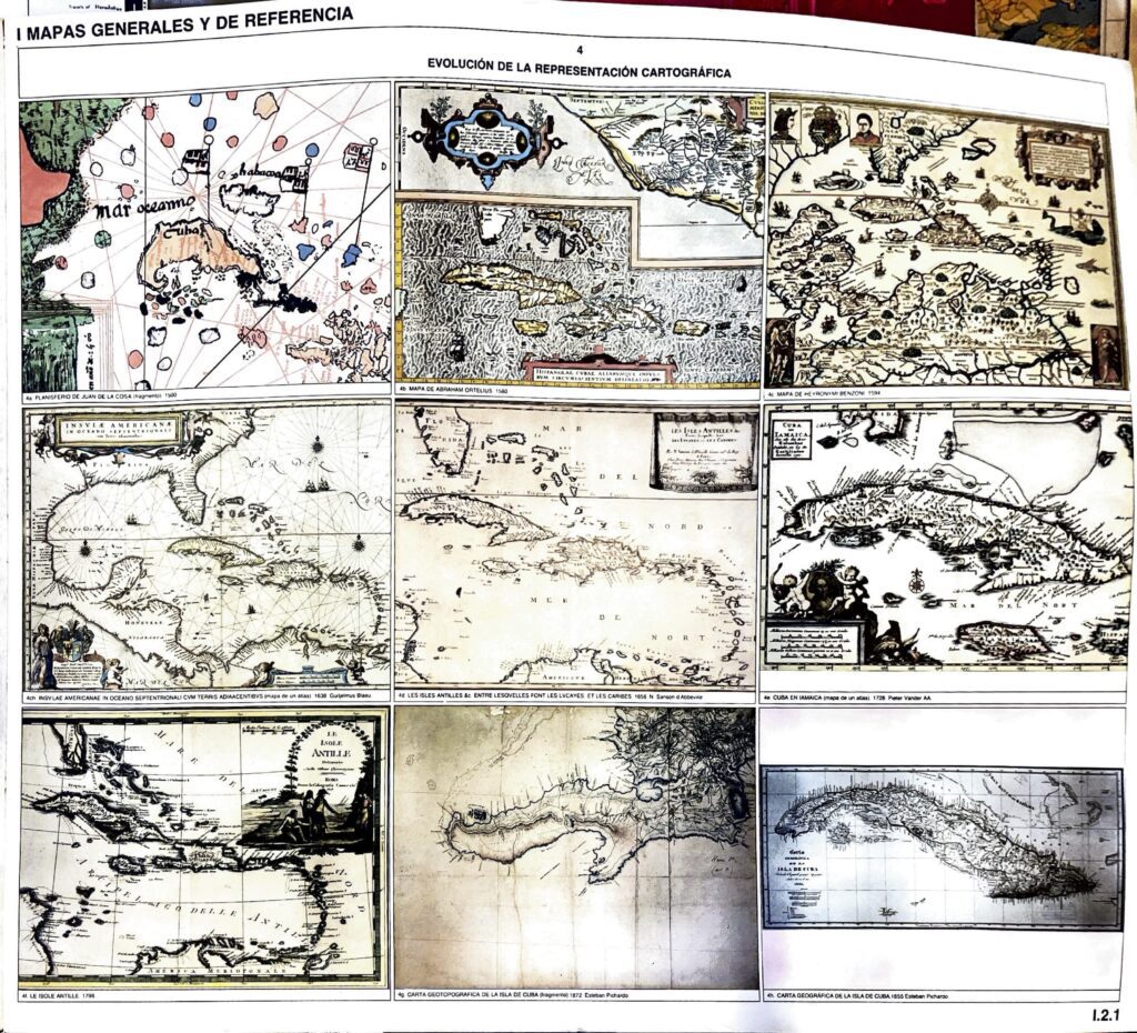
I’m going to continue on my Central America map journey this week by featuring a series of
maps from Cuba, specifically focusing on this front page with a collage of maps of Cuba from
the last 500 years. I have included the other pages as well, which include a general topographic map of Cuba and city maps of Havana, Pinar del Río, Matanzas, and Santa Clara.
Going from OLDEST to YOUNGEST…
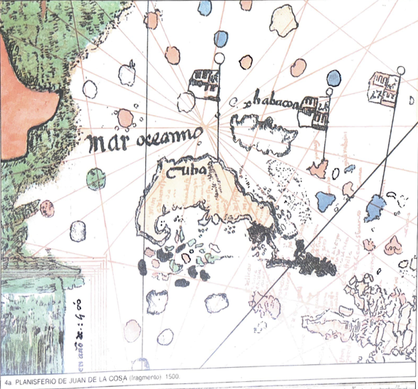
(4a) Planisferio de Juan de la Cosa (fragmento), 1500
This map, supposedly the first one ever drawn of the Americas on a piece of oxhide, is
authored by Juan de la Cosa. He was a Castilian navigator and cartographer, and sailed
alongside Columbus in three voyages across the Atlantic. He ultimately came to the Americas
seven times, drew up the Americas sometimes along the way, and died from a poison arrow.
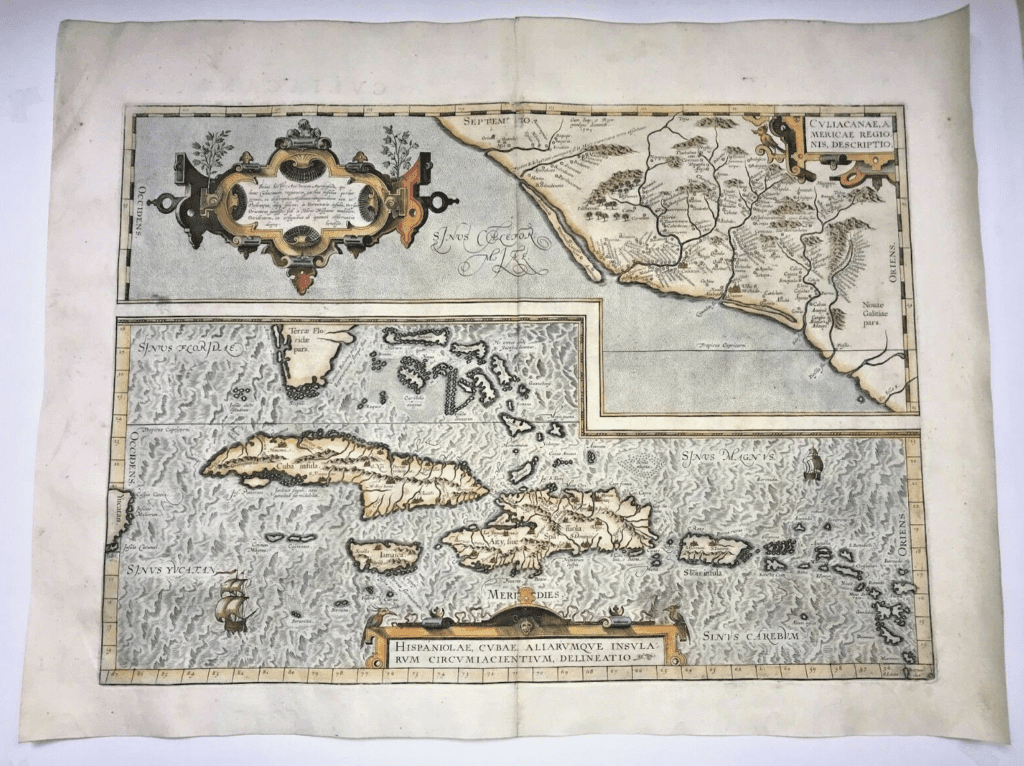
(4b) Mapa de Abraham Ortelius, 1580
Abraham Ortelius was a cartographer, geographer, and cosmographer from Antwerp (Belgium)
in the Spanish Netherlands. He’s known for creating the first atlas (book of maps in the same
format and display) and is (allegedly) the first person to suggest continental drift by observing
the puzzle piece shapes of the continents. (Alfred Wegener is the actual first to propose the
theory of continental drift in 1912.) This snippet of Ortelius features Cuba, the Caribbean,
and Northwestern Mexico.
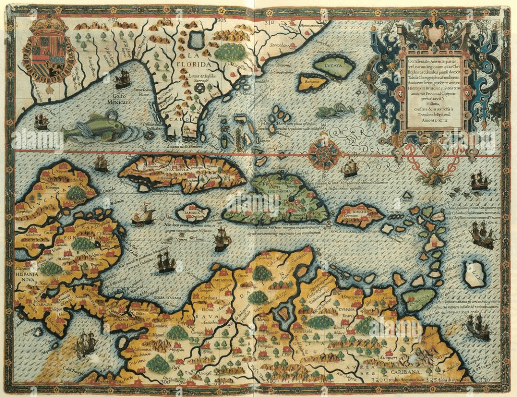
(4c) Mapa de Heyronymi Benzoni, 1594
Benzoni was a Spanish cartographer who sailed to the Caribbeans/Americas in 1541 and spent
fourteen years traveling. It was published later, presumably by Theodor de Bry, a Walloon
engraver, goldsmith, editor and publisher. He was a key figure in showing the Americas to the
Europeans through his engravings. (This one is is more controversial – depictions of royalty and
important figures on the top of the map vs warlike Natives on the bottom corners of the
maps.)
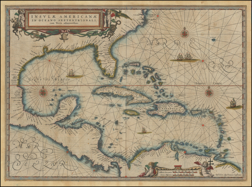
(4ch.) Insulae Americanae in Oceano Septentrionali cum terris adiacentibus, 1638, Willem/
Johannes Blaeu).
This is a Dutch rendition of the southeast coast of North America to South America to the
west coast of Central America including the West Indies and Cuba! Willem Janszoon Blaeu was
a Dutch cartographer, atlas maker, and publisher. His son is Johannes Blaeu, who was the
official cartographer of the Dutch East India Company. (This one is probably my favorite, it
feels very posh and simplistic.)
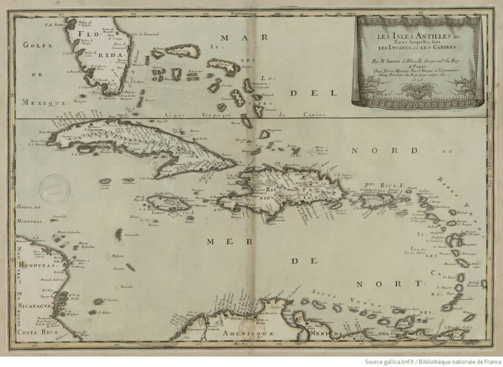
(4d) Les Isles Antilles &c. Entre lesquelles sont les Lucayes, et les Caribes, 1656, Sanson
d’Abbeville.
This map is authored by Nicolas Sanson, the “father of French cartographer.” It is part of an
atlas titled “L’Amerique en plusieurs cartes, & en divers traitte’s de geographie et d’histoire.”
Originally, it was intricately engraved on copper plates, a common technique in the 17th
century that allowed for detailed line work. You can see that there is still a focus on
aesthetics.
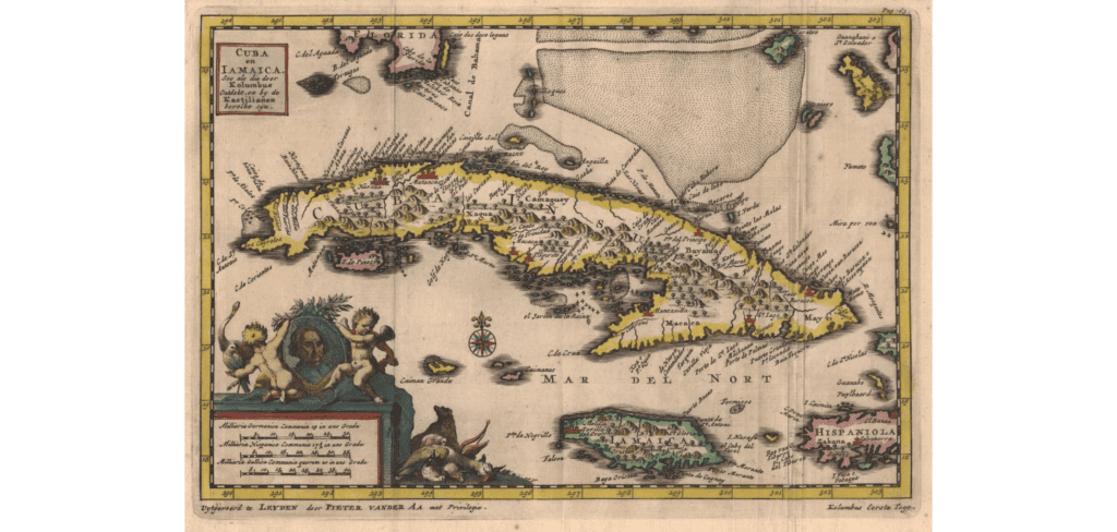
(4e) Cuba en Iamaica (mapa de un atlas). 1728. Pieter van der Aa.
Pieter van der Aa was a Dutch publisher best known for preparing maps and atlases. The
portrait in the bottom left is of William IV, Prince of Orange. If you’re wondering why naked
babies are clinging to this portrait, it is because these babies—putti—served as powerful
symbols of things like innocence and purity and God’s presence; they’re rooted in Renaissance
and Baroque concepts.
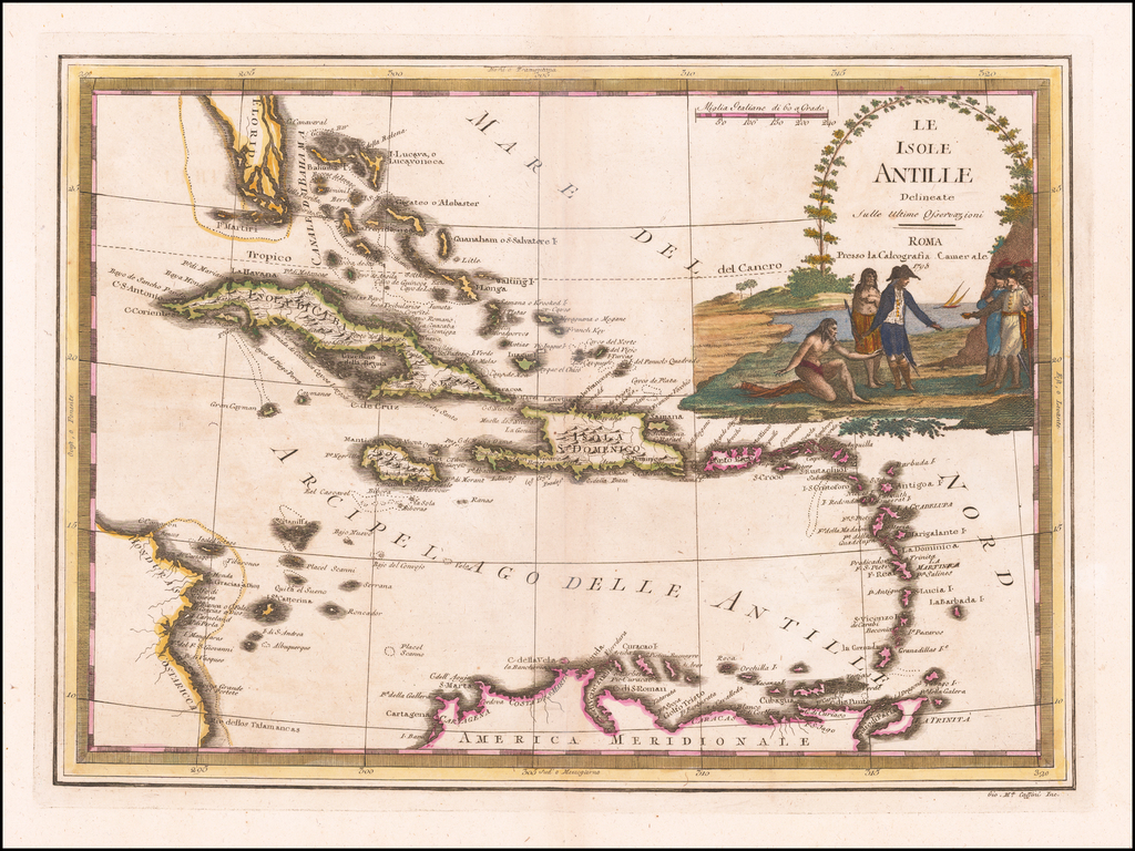
(4f) Le Isole Antille. 1798. Giovanni Maria Cassini
Giovanni Maria Cassini was a Rome based Italian mathematician, globe maker, geographer,
engraver, and cartographer. He invented a new form of projection, the Cassini projection,
which is a cylindrical, equidistance map projection. This map shows Florida, Cuba, Puerto
Rico, and other Caribbean islands.
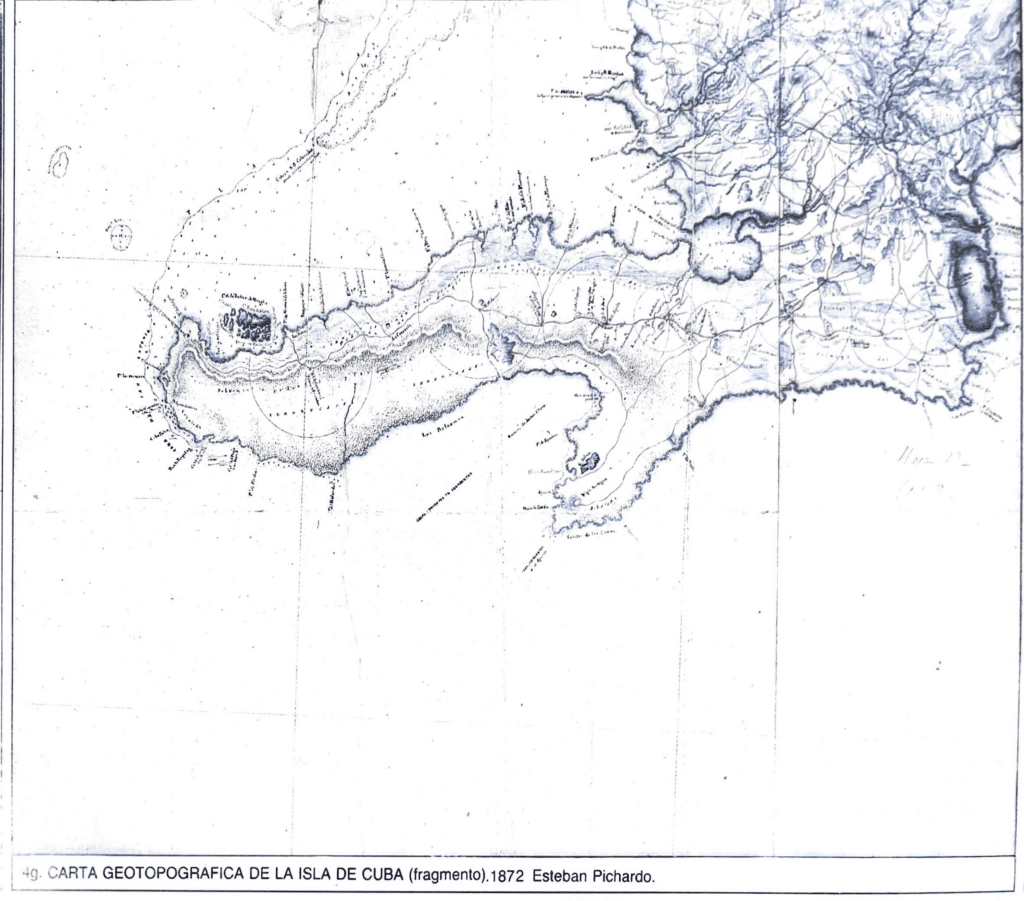
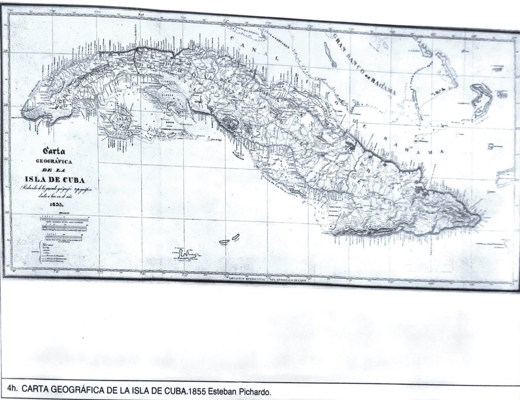
(4g/h) Carta Geotopografia de la Isla de Cuba (fragmento). 1855/1872. Esteban Pichardo.
Esteban Pichardo is a !!CUBAN!! geographer who is known as the “father of Cuban
geography.” Though he was born in Santo Domingo, he lived and studied in Cuba from the age
of 2 and obtained a law degree. Then, he transitioned to cartography and his master work was
the first indigenous atlas of Cuba, published in 1874 along with a massive 3 sheet map of the
island.
Hope you enjoyed!!
See you next week 🙂